WHAT CAN I DO WITH MY LAND?
If you are unsure if you can subdivide, or what surveying and subdivision is, then below are some links to helpful information which may be relevant to you or your property.
Do I need a Consent?
If you want to subdivide you need a consent (Subdivision Consent).
If you are undertaking an activity that is not permitted under your local council district or city plan you need a consent (Land Use Consent).
Subdivision Consents
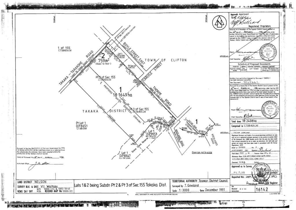
Under the current consenting framework all subdivision activities need a subdivision consent from the local council and approval of the surveyors plans. At a minimum local councils specify that subdivision is a controlled activity. Prior to 1991 cross leases were a way of dividing land without a subdivision consent, however, this is no longer the case. Examples of subdivisions that require consents include the following:
– Urban Subdivision
– Boundary Adjustment
– Rural Subdivision
– Cross Lease (any lease of over 30 years)
– Unit Title Subdivision
– Strata Freehold Subdivision
The registration of a ROW easement without a subdivision does not require a full consent, however, a limited consent application process is required.
Land Use Consents
Land use consents are required for some of the following:
– Yard Reduction
– Commercial or Industrial Activities in a Residential Zone and vice versa.
– Retaining walls within 1.5m of a boundary and over 1.5m high (or load bearing).
– Encroachment through daylighting/recession plane envelope.
– Increases in site coverage beyond permitted thresholds.
– Discharge of stormwater.
– Earthworks (generally for larger volumes or sensitive areas only).
– Remediating contaminated soils (e.g. changing land use from orchard to residential).
– Large advertisements.
You local council will set the requirements in your region, and they will also vary in each zone within that region. The rules that govern consenting can be confusing so it is best to engage us at an early stage to discuss whether you require a consent or not.
Below are links to the Tasman District Plan and the Nelson City Plan.
The local Council in your area determines what activities require a resource consent. The framework and basis for the consent process is governed by the rules of the Resource Management Act 1991. Under the requirements of the Resource Management Act 1991 councils are required to classify activities within their region as one of the following:
Permitted Activity
No consent Required
Controlled Activity
A consent is required, council can set rules, however, they must grant consent. Basic subdivision and land use activities fall into this category.
Restricted Discretionary Activity
A consent is required and Council can grant or deny the application. However, the Council can only deny the application in relation to rules for which they have specified their discretion in the District/City Plan. Basic subdivision and land use can fall into this category.
Discretionary Activity
A consent is required and Council can grant or deny the application. These types of applications often require supporting evidence to show that the effects will be minimal and they are of economic and social benefit. Typically more complex subdivision and land use consents fall into this category.
Non Complying Activity
A consent is required and Council can grant or deny the application. Generally speaking Council will only grant consent for these applications if they meet the objectives and policies of the District/City Plan, the Regional Council Regional Plan, and the adverse effects of the activity will be no more than minor.
Prohibited Activity
These types of activities are specifically listed in the District/City Plan and consent will not be granted.
If you think you might need a consent and want to find out more, or if you want assistance submitting a subdivision or land use consent call us today.
What is the General Process of Subdividing my Property?
The subdivision process is generally as follows. Although every site is different the same general steps apply whether the property is rural, urban, 2 lot, or multi lot, or simply a boundary adjustment.
This process is set out in the Resource Management Act 1991 and the key steps are listed below:
Consent Application
We engage any necessary third parties to undertake any required reports to support the application. These can include geotechnical reports, traffic impact assessments, or soil contamination reports.
We will also draft the ‘scheme plan’ which is a general plan of how the title plan will look for council to assess in the application. As a part of this basic surveying may be neccessary to check levels on the boundary or of retaining walls, or to confirm accurately the location of buildings and services.
We will then draft the subdivision consent application and assessment of environmental effects and submit them to the local Council.
Council processes the Application.
This normally takes 20 working days but can often include extensions for responses to Council requests for information.
Consent is granted. We are now able to engage contractors on your behalf to undertake any required works to meet the consent conditions.
Often clients engage a real estate agent to advertise any property to be sold at this time.
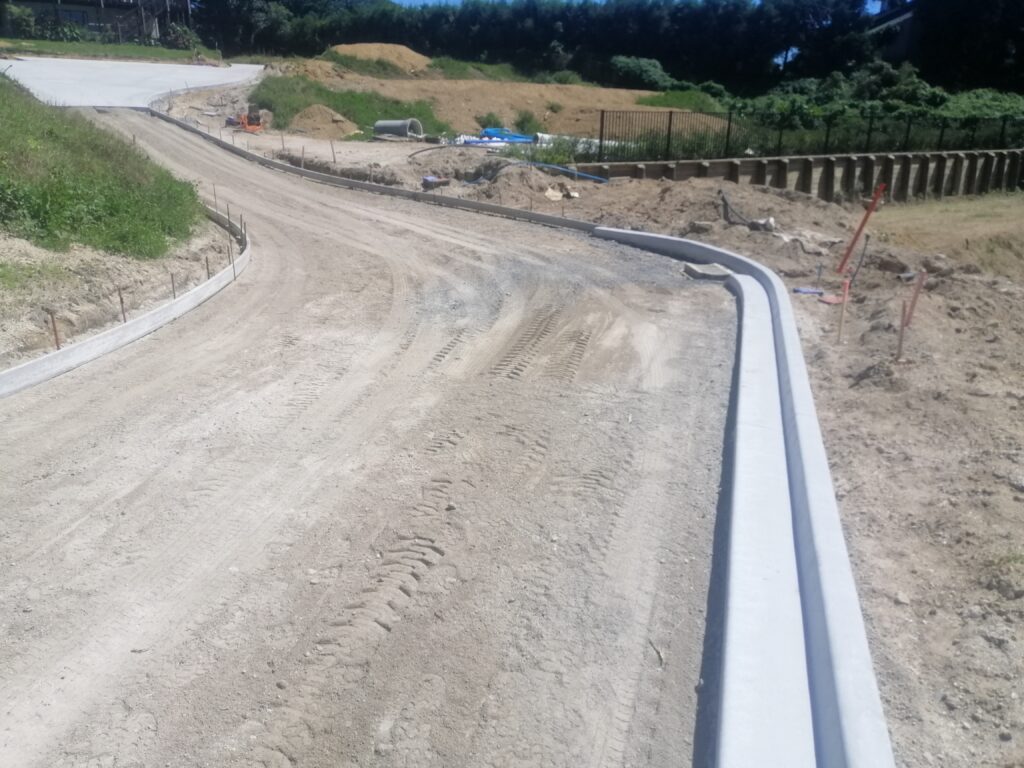
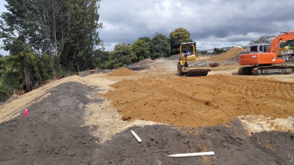
Civil works are undertaken.
We will monitor the work to ensure it is being undertaken adequately and certify it.
We will contact the utiity companies to arrange connection of power, fibre/telephone.
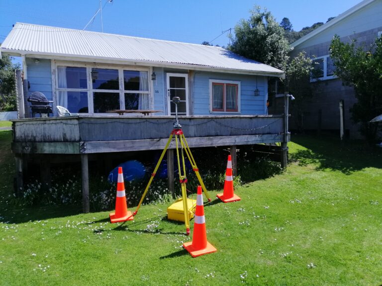
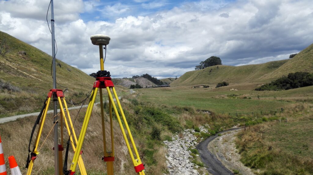
Surveying for the subdivision plan.
We will visit the site to undertake pegging and surveying of fencelines etc.
We submit the survey plans and civil paper work to council for approval (often called 223/224 approval).
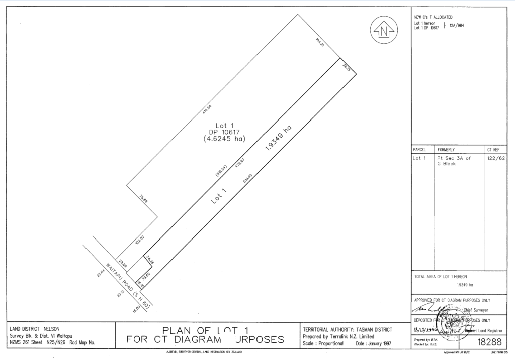
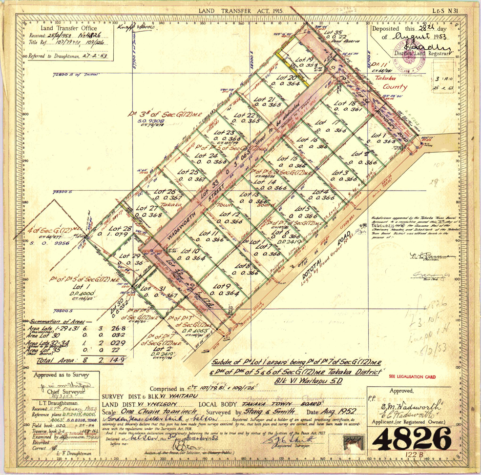
We submit the survey plan to Land Information New Zealand (LINZ) for approval.
We then notify your lawyer that the survey plan has been approved and they then undertake the process of creating new titles . Once approved by LINZ the titles issue and the process is completed.

Urban Subdivision:
I am in an urban area in Tasman, can I subdivide?
Most of the residential land within Takaka, Motueka, and the other towns in the Tasman District is zoned ‘residential’. This is shown in lavender on the Top of the South Maps. This land is generally subdividable with a subdivision consent; if it meets the below criteria. However, even if it doesn’t in some cases the land may still be subdividable. It is worthwhile getting in touch with us to discuss your options. Your property may also be zoned future residential, which means subdivision may be possible now or in the future.
What is the minimum complying lot size in the residential zone?
– In areas with Council sewer and water services 350 square metres (Motueka/Richmond) or 450 square metres (Takaka, Collingwood, Pohara, Tata, Kaiteriteri, Riwaka etc). This is the net area excluding private accessways/right of ways.
– In areas without water and sewage servicing generally 1,000 square meters, which allows for septic systems and rain harvesting systems on each site.
The following average net area requirements also apply to subdivisions producing three or more allotments:
– 1,200 square meters – unserviced areas.
– 600 square meters – serviced areas.
– 500 square meters – Motueka urban.
– 450 square meters – Richmond urban.
What is the minimum distance of buildings to boundaries in the residential zone?
1.5 metres to the side or rear of your property (or less with the consent of your neighbour) on one side (3.0 metres on the others).
1.0 metres from private right of ways.
1.5 metres accessory buildings.
4.0 metres from any public road to a dwelling.
5 metres from a public road for garage doors.
What is the minimum access width in the residential zone?
– 4.5 metres legal width and 2.75m sealed carriageway when servicing 1 – 6 residential lots. You also require a passing bay every 50m if your access exceeds that length. The same standards apply to both Nelson and Tasman.
I am in Nelson City can I subdivide?
Most of the land in Nelson City is zoned general residential, and medium density residential zones also cover relatively large areas around the Nelson and Stoke commercial areas. You can call us to discuss your property if you are unsure which zone your property is in, however, if it is inside the general residential or medium density zone the land is generally subdivideable with a subdivision consent if it meets the below criteria. However, even if it doesn’t it may still be possible to subdivide, so it is a good idea to confirm your plans.
What is the minimum complying lot size?
– In the general or standard residential area (pale yellow on the city plan) the minimum site area is 400 square meters. This is the net area excluding private accessways/right of ways.
– In the medium density residential area or higher density area (pale blue on the city plan) the minimum site area is 300 square meters. This is the net area excluding private accessways/right of ways. There are also site coverage, shape factor, and outdoor living requirements which can impact on subdivisions on smaller sites.
What is the minimum distance of buildings to boundaries in the residential zone?
1.5 metres to the side or rear of your property (or less with the consent of your neighbour). Up to 12m of total building length can be contained within 1.5m of your boundary (fire rating requirements will apply if the building elements are closer than 1.0m to the boundary).
1.5 metres from any public road to a dwelling.
2.5 metres from a public road for garage doors (provided the dwelling is 1.5m from the road boundary).
What is the minimum access width in the suburban residential zone?
– 4.5 metres legal width and 2.75m sealed carriageway when servicing 1 – 6 residential lots. You also require a passing bay every 50m if your access exceeds that length. The same standards apply to both Nelson and Tasman.
Urban Subdivision:
I am in town in the Tasman Region. Can I subdivide?
Most of the residential land within Takaka, Motueka, and the other towns in the Tasman District is zoned ‘residential’. This is shown in lavender on the Top of the South Maps. This land is generally subdividable with a subdivision consent; if it meets the below criteria. However, even if it doesn’t in some cases the land may still be subdividable. It is worthwhile getting in touch with us to discuss your options. Your property may also be zoned future residential, which means subdivision may be possible now or at some stage soon.
What is the minimum complying lot size in the Tasman residential zone?
– In areas with Council sewer and water services 350 square metres (Motueka/Richmond) or 450 square metres (Takaka, Collingwood, Pohara, Tata, Kaiteriteri, Riwaka etc). This is the net area excluding private accessways/right of ways.
– In areas without water and sewage servicing generally 1,000 square meters, which allows for septic systems and rain harvesting systems on each site.
The following average net area requirements also apply to subdivisions producing three or more allotments:
– 1,200 square meters – unserviced areas.
– 600 square meters – serviced areas.
– 500 square meters – Motueka urban.
– 450 square meters – Richmond urban.
What is the minimum distance of buildings to boundaries in the residential zone?
1.5 metres to the side or rear of your property (or less with the consent of your neighbour) on one side (3.0 metres on the others).
1.0 metres from private right of ways.
1.5 metres accessory buildings.
4.0 metres from any public road to a dwelling.
5 metres from a public road for garage doors.
What is the minimum access width in the Tasman residential zone?
– 4.5 metres legal width and 2.75m carriageway when servicing 1 – 6 residential lots.
I am in Nelson City. Can I subdivide?
Most of the land in Nelson City is zoned general residential, and medium density residential zones also cover relatively large areas around the Nelson and Stoke commercial areas. You can call us to discuss your property if you are unsure which zone your property is in, however, if it is inside the general residential or medium density zone the land is generally subdivideable with a subdivision consent if it meets the below criteria. However, even if it doesn’t it may still be possible to subdivide, so it is a good idea to confirm your plans.
What is the minimum complying lot size?
– In the general or standard residential area (pale yellow on the city plan) the minimum site area is 400 square meters. This is the net area excluding private accessways/right of ways.
– In the medium density residential area or higher density area (pale blue on the city plan) the minimum site area is 300 square meters. This is the net area excluding private accessways/right of ways. There are also site coverage, shape factor, and outdoor living requirements which can impact on subdivisions on smaller sites.
What is the minimum distance of buildings to boundaries in the suburban residential zone?
1.5 metres to the side or rear of your property (or less with the consent of your neighbour). Up to 12m of total building length can be contained within 1.5m of your boundary (fire rating requirements will apply if the building elements are closer than 1.0m to the boundary).
1.5 metres from any public road to a dwelling.
2.5 metres from a public road for garage doors (provided the dwelling is 1.5m from the road boundary).
What is the minimum access width in the residential zones?
– 4.5 metres legal width and 2.75m sealed carriageway when servicing 1 – 6 residential lots. You also require a passing bay every 50m if your access exceeds that length. The same standards apply to both Nelson and Tasman.
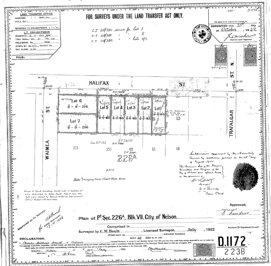
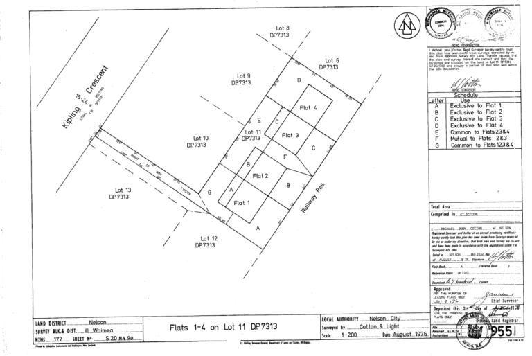
Cross Lease:
What is a Cross Lease?
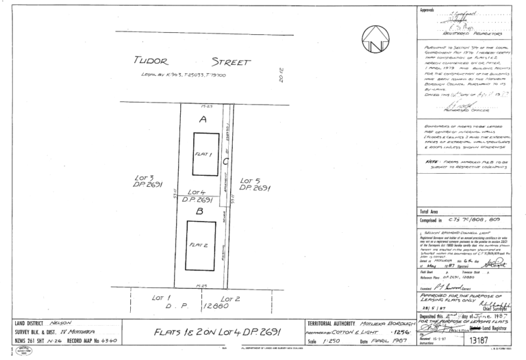
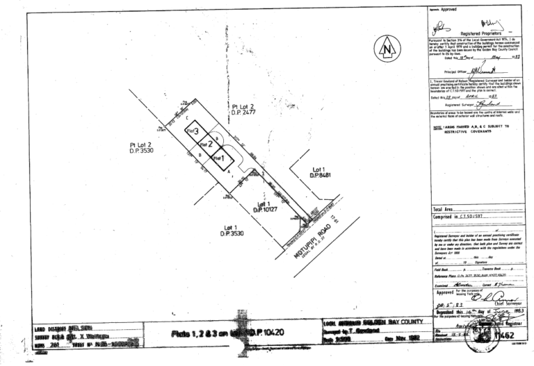
Cross Leases were a form of land ownership developed by the legal profession in the 1970’s to allow for ‘subdivision’ of parcels at a greatly reduced cost by avoiding the full subdivision process. This process was effectively stopped in 1991 with the introduction of the Resource Management Act which deemed any lease of 30 years or more to be considered a subdivision. Cross leases are common in Nelson and there are some present in Motueka and Takaka. A cross lease is normally a lease document or series of lease documents including surveyors plans through which the common owners of the underlying freehold or ‘fee simple’ title grant exclusive rights to areas and buildings on that property for a period of 999 years. A cross lease can be brought and sold along with the associated share in the underlying freehold title in the same way as freehold titles.
However, the key weakness with cross lease titles is that the lease documents and plans refer to the site features and buildings at the time that the cross lease flat plan was created (probably 30 – 50 years ago). By virtue of the nature of the ownership by lease these buildings cannot be added to or modified without potentially rendering the cross lease title defective. Put plainly, the plans and title will not match the features on the site.
Unfortunately, a deficient cross lease can effect the ability to get a mortgage or insurance over the property, and also council consents, so often they need addressing at the time of sale. Many owners are unaware of any issue with their title until it becomes a problem.
It is possible to update the flats plan and cross lease documents. This is not commonly done these days, rather if owners are going to the effort and expense of updating a flats plan they will normally undertake a subdivision to convert their property to a freehold title. Conversion from cross lease to freehold titles is a common process. We can assist you with this and give you an accurate cost estimate of what is required. There are certain circumstances in which an owner may wish to update their flats plan, in this case the process is outlined briefly below.
I need to update my Cross Lease flats plan what do I do?
If you are located in Tasman or Nelson and want to update your flats plan you have come to the right place. Surveyit can assist you with updating your flats plan or converting it to a freehold title. You will need the consent of all of the common owners of the underlying freehold title over which the cross lease is registered in order to modify the cross lease. It is worth talking to them early in the process and before you make any changes or invest too much time and money as you cannot proceed without their agreement.
To update a cross lease in Tamsan or Nelson City you need a subdivision consent and a subdivision application is lodged.
The first step following talking with us and the other common owners of the property is for us to apply to council for consent to update the plans. The council will assess the application against the relevant rules in the district plan that apply to the zone in which the property is located.
Once consent is granted Surveyit will undertake the survey and drafting work required to produce an updated plan of the lease areas and lodge it with Council and Land Information New Zealand for approval.
Following that your lawyer will update the lease documents which will reference the new plan(s) and the process.
Should I update my Cross Lease plan or undertake a conversion to Freehold?
We almost always recommend to clients that if they are going to the trouble of updating their flats plan that they undertake a conversion to a freehold title. Firstly, if you have a freehold or ‘fee simple’ title you can undertake modifications or changes to your buildings and land in the future without updating needing to update a flats plan again or get your neighbours approval for the modification. If you have agreeable neighbours it is best to gain freehold title while you are all agreed and share the costs. Having a freehold title normally adds value to your property in excess of the cost difference between undertaking the update of the cross lease plan and a freehold subdivision.
The key difference in process between updating a flats plan and a freehold subdivision relates to the civil servicing of the properties. Councils require the individual freehold lots have their own service connections. At the time of the cross lease being created both houses may not have been provided with separate sewerage, and water connections. The properties may also share soak holes for stormwater, or in some cases even power connections and fuse boxes. As the cost of undertaking the necessary surveying is not significantly different in either scenario, it is the cost of upgrading these council services which can make the difference. Our view is that normally it is worthwhile undertaking the required modifications to meet the council standard as often the changes required are minor. Also, in some instances the existing servicing is poorly constructed or laid out which may lead to increased maintenance and ownership issues in the future.

Cross Lease:
What is a Cross Lease?
Cross Leases were a form of land ownership developed by the legal profession in the 1970’s to allow for ‘subdivision’ of parcels at a greatly reduced cost by avoiding the full subdivision process. This process was effectively stopped in 1991 with the introduction of the Resource Management Act which deemed any lease of 30 years or more to be considered a subdivision. Cross leases are common in Nelson and there are some present in Motueka and Takaka. A cross lease is normally a lease document or series of lease documents including surveyors plans through which the common owners of the underlying freehold or ‘fee simple’ title grant exclusive rights to areas and buildings on that property for a period of 999 years. A cross lease can be brought and sold along with the associated share in the underlying freehold title in the same way as freehold titles.
However, the key weakness with cross lease titles is that the lease documents and plans refer to the site features and buildings at the time that the cross lease flat plan was created (probably 30 – 50 years ago). By virtue of the nature of the ownership by lease these buildings cannot be added to or modified without potentially rendering the cross lease title defective. Put plainly, the plans and title will not match the features on the site.
Unfortunately, a deficient cross lease can effect the ability to get a mortgage or insurance over the property, and also council consents, so often they need addressing at the time of sale. Many owners are unaware of any issue with their title until it becomes a problem.
It is possible to update the flats plan and cross lease documents. This is not commonly done these days, rather if owners are going to the effort and expense of updating a flats plan they will normally undertake a subdivision to convert their property to a freehold title. Conversion from cross lease to freehold titles is a common process. We can assist you with this and give you an accurate cost estimate of what is required. There are certain circumstances in which an owner may wish to update their flats plan, in this case the process is outlined briefly below.
I need to update my Cross Lease flats plan what do I do?
If you are located in Tasman or Nelson and want to update your flats plan you have come to the right place. Surveyit can assist you with updating your flats plan or converting it to a freehold title. You will need the consent of all of the common owners of the underlying freehold title over which the cross lease is registered in order to modify the cross lease. It is worth talking to them early in the process and before you make any changes or invest too much time and money as you cannot proceed without their agreement.
The first step following talking with us and the other common owners of the property is for us to apply to council for consent to update the plans. The council will assess the application against the relevant rules in the district plan that apply to the zone in which the property is located.
Once consent is granted Surveyit will undertake the survey and drafting work required to produce an updated plan of the lease areas and lodge it with Council and Land Information New Zealand for approval.
Following that your lawyer will update the lease documents which will reference the new plan(s) and the process.
Should I update my Cross Lease plan or undertake a conversion to Freehold?
We almost always recommend to clients that if they are going to the trouble of updating their flats plan that they undertake a conversion to a freehold title. Firstly, if you have a freehold or ‘fee simple’ title you can undertake modifications or changes to your buildings and land in the future without updating needing to update a flats plan again or get your neighbours approval for the modification. If you have agreeable neighbours it is best to gain freehold title while you are all agreed and share the costs. Having a freehold title normally adds value to your property in excess of the cost difference between undertaking the update of the cross lease plan and a freehold subdivision.
The key difference in process between updating a flats plan and a freehold subdivision relates to the civil servicing of the properties. Both WBOPDC and TCC require the individual freehold lots have their own service connections. At the time of the cross lease being created both houses may not have been provided with separate sewerage, and water connections. The properties may also share soak holes for stormwater, or in some cases even power connections and fuse boxes. As the cost of undertaking the necessary surveying is not significantly different in either scenario, it is the cost of upgrading these council services which can make the difference. Our view is that normally it is worthwhile undertaking the required modifications to meet the council standard as often the changes required are minor. Also, in some instances the existing servicing is poorly constructed or laid out which may lead to increased maintenance and ownership issues in the future.
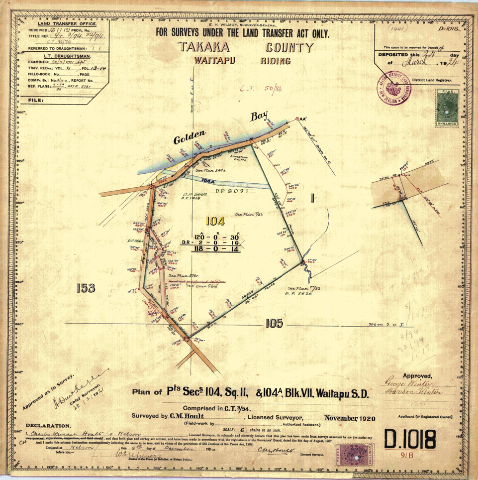
Rural Subdivision:
I am in Tasman (Rural) can I subdivide?
Most privately owned rural land in Tasman is zoned ‘Rural 1’, ‘Rural 2’, or ‘Rural Residential’, with some smaller areas of ‘Rural 3’.
Rural 1 is generally the higher productive capacity land which is flat and more fertile (flood plains and river flats) and is typically used for dairy farming in Golden Bay or horticulture in the Motueka/Riwaka area. Smaller allotments are allowed in this zone reflecting the potential for higher intensity rural productive activities.
Rural 2 is the lower productive land. Generally this land is sloping, rocky, or lower fertility. Typically this land is used for sheep or sometimes beef farming throughout the district. Subdivision is very restricted in this area due to perception that the land has lower productive capacity/versatility.
Rural 3 is the rural land surrounding areas of development and rural residential land in Mapua and Moutere. This land while rural is more developed than the other rural areas, but the subdivision rules are now more restrictive (similar to Rural 2).
There are options for subdivision in the rural zones, however, the criteria are more case by case. Subdivision of your rural property may be possible, particularly if it meets some of the key rules are outlined below.
Areas of land zoned rural residential are air marked by the District Council for development into lifestyle blocks, so subdivision is proposed/supported and servicing is generally the key issue with these sites. Rural land in the rural residential zone can generally be subdivided with a subdivision consent. It is likely the council consent will be granted if the subdivision meets the basic criteria below. However, there are exceptions where a subdivision doesn’t meet these criteria but is still possible, so it is worth getting in touch to discuss the likely outcome of your proposal.
What is the minimum complying lot size in the rural zones?
– Rural 1: 5,000 square metres minimum, with a 12 hectare average lot size (provided your title is older than 2016).
– Rural 2: 5,000 square metres minimum, with a 50 hectare average lot size (provided your title is older than 2016). Subdivision which does not meet this lot size criteria is still possible in the Rural 2 zone, however, it is entirely at the council’s discretion. A good reasoning (such as topography, geography, or a current or proposed land use) will be required.
Rural 3: 50 hectares minimum can be subdivided. Allotments that are already 50 hectares may be subdivided at the councils discretion. Specific subdivision rules apply to the Ruby Bay area.
What is the minimum distance of buildings to boundaries in the rural zones?
– Rural 1: Dwellings are required to be 30 metres from any internal boundary and 10 metres from any road boundary. Non-habitable buildings are required to be 5 metres from internal boundaries, however, they may be located less than 5 metres from the boundaries with neighbours consent.
– Rural 2: Generally, dwellings are required to be 10m from the road and 30m from internal boundaries, though their are exceptions. Generally other buildings are required to be 10 metres from road boundaries, or 5 metres from internal boundaries. For non-habitable buildings (garages, sheds etc), they may be located less than 5 metres from the boundaries with neighbours consent.
Rural 3: Generally all buildings are required to be 10 metres from road boundaries, or 5 metres from internal boundaries.
In most cases setbacks may be reduced with a simple resource consent. Normally the permission of the relevant neighbour and a waiver of possible effects (noise etc) is a prerequisite for this consent to be approved.
What is the minimum access width in the rural zones?
– Rural 1, 2, and 3: 6.0m legal width and 2.5m carriageway width (2-6 allotments).
– Rural Residential: 5.0m legal width and 2.75m/3.0m carriageway width.
What are the minimum complying lot sizes in the rural residential zones?
Specific lot sizes apply to each area within the rural residential zone and are often dependant on whether the property is reticulated for waste water (serviced). The basic areas and rules are listed below, other specific rules do apply.
– Serviced allotments in Richmond: 2,000 square metres.
– Serviced allotments in Ruby Bay, Collingwood, Pohara Valley Road, Ligar Bay South, and Central Takaka: 2,500 square metres.
– Serviced allotments in Motueka: 3,000 square metres.
– Unserviced allotments in Milnthorpe: 3,000 square metres.
– Unserviced allotments at Eighty Eight Valley, Richmond, Kina Triangle, Premin Road, Alpine Meadows, Tophouse Road, Onekaka, Pohara Valley Road, Riwaka-Kaiteriteri, Wakefield, and Mariri: 5,000 square metres.
– Unserviced allotments at Tata Headland North and Upper Ligar Bay: 1 hectare.
– Unserviced allotments at Kina, Redwood Valley, Ligar Bay North, Patons Rock, Mapua, Craigieburn Road, Upper Haile Lane Pohara, Parapara Valley, and Rocklands Road North, Clifton : 2 hectares.
– Unserviced allotments at Puponga, Bainham, Aorere Valley, Tukurua, Parapara, and Upper Moutere: 4 hectares.
Rural Subdivision:
I am in the Tasman District (Rural). Can I subdivide?
What is the minimum complying lot size in the rural zones?
Rural 1: 5,000 square metres minimum, with a 12 hectare average lot size (provided your title is older than 2016).
– Rural 2: 5,000 square metres minimum, with a 50 hectare average lot size (provided your title is older than 2016). Subdivision which does not meet this lot size criteria is still possible in the Rural 2 zone, however, it is entirely at the council’s discretion. A good reasoning (such as topography, geography, or a current or proposed land use) will be required.
– Rural 3: 50 hectares minimum can be subdivided. Allotments that are already 50 hectares may be subdivided at the councils discretion. Specific subdivision rules apply to the Ruby Bay area.
What is the minimum distance between buildings and boundaries in the rural zones?
– Rural 1: Dwellings are required to be 30 metres from any internal boundary and 10 metres from any road boundary. Non-habitable buildings are required to be 5 metres from internal boundaries, however, they may be located less than 5 metres from the boundaries with neighbours consent. – Rural 2: Generally, dwellings are required to be 10m from the road and 30m from internal boundaries, though their are exceptions. Generally other buildings are required to be 10 metres from road boundaries, or 5 metres from internal boundaries. For non-habitable buildings (garages, sheds etc), they may be located less than 5 metres from the boundaries with neighbours consent. – Rural 3: Generally all buildings are required to be 10 metres from road boundaries, or 5 metres from internal boundaries. In most cases setbacks may be reduced with a simple resource consent. Normally the permission of the relevant neighbour and a waiver of possible effects (noise etc) is a prerequisite for this consent to be approved.What is the minimum access width in the rural zone?
– 6.0 metres servicing 1 – 3 rural lots
-8.0 metres servicing 4 – 6 rural lots
What is the minimum complying lot size in the rural residential zones?
Specific lot sizes apply to each area within the rural residential zone and are often dependant on whether the property is reticulated for waste water (serviced). The basic areas and rules are listed below, other specific rules do apply. – Serviced allotments in Richmond: 2,000 square metres – Serviced allotments in Ruby Bay, Collingwood, Pohara Valley Road, Ligar Bay South, and Central Takaka: 2,500 square metres. – Serviced allotments in Motueka: 3,000 square metres. – Unserviced allotments in Milnthorpe: 3,000 square metres. – Unserviced allotments at Eighty Eight Valley, Richmond, Kina Triangle, Premin Road, Alpine Meadows, Tophouse Road, Onekaka, Pohara Valley Road, Riwaka-Kaiteriteri, Wakefield, and Mariri: 5,000 square metres. – Unserviced allotments at Tata Headland North and Upper Ligar Bay: 1 hectare. – Unserviced allotments at Kina, Redwood Valley, Ligar Bay North, Patons Rock, Mapua, Craigieburn Road, Upper Haile Lane Pohara, Parapara Valley, and Rocklands Road North, Clifton : 2 hectares. – Unserviced allotments at Puponga, Bainham, Aorere Valley, Tukurua, Parapara, and Upper Moutere: 4 hectares.